Article - Population Change around the Central Salish Sea between 2006 and 2011 - a closer look
Population Change around the Central Salish Sea
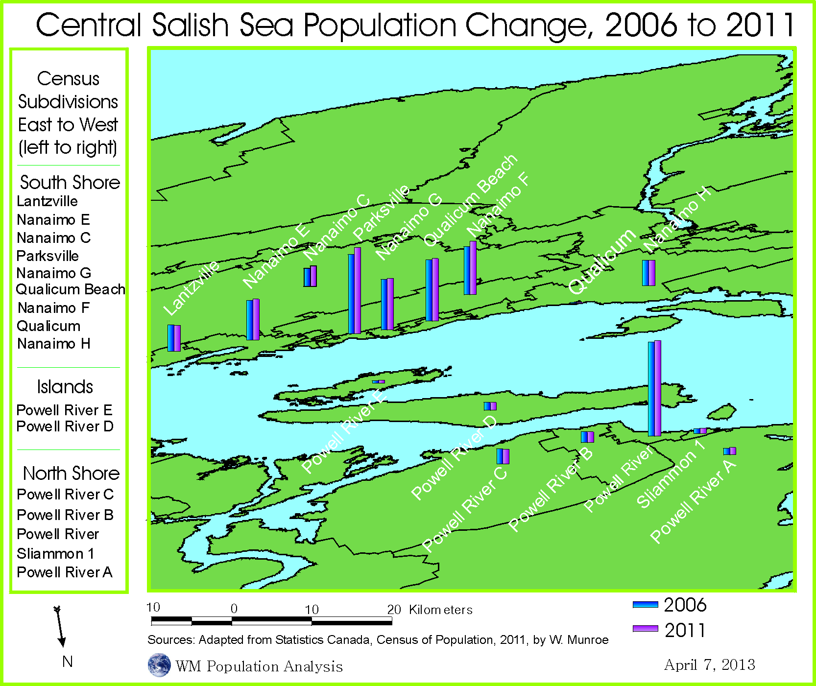
Of the census subdivisions surrounding the Central Salish Sea, the largest population resides in the City of Powell River on the north shore. Parksville and Qualicum Beach, both on the southern shore, have the second and third largest populations respectively.
Source: Statistics Canada, 2011 census, Census of Population. Map by W. W. Munroe.
Between 2006 and 2011, for many csds surrounding the Central Salish Sea, the population counts increased marginally, while some csds had slightly lower counts. Population growth slowed compared to growth between 2001 to 2006.
Approaching the Salish Sea from the North
The map of the Central Salish Sea uses a projection of the world (centered over western Russia) to view the central Salish Sea and the surrounding census subdivisions, from the north . Click on the globe for a larger image. Use the "back" button to return to this page.